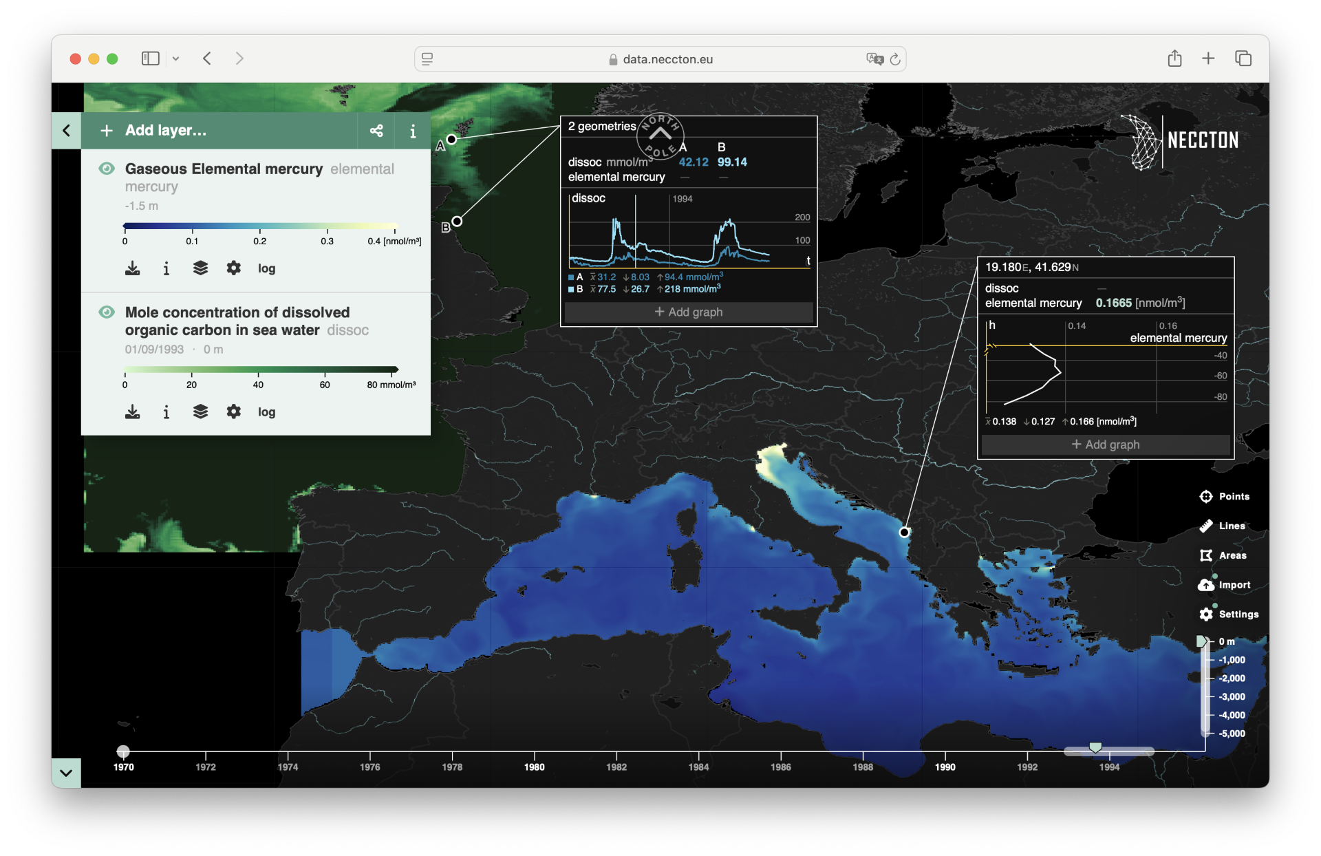
NECCTON Data Viewer – Explore, analyse, and share marine data

The NECCTON Data Viewer is an upcoming interactive tool designed to visualize and distribute NECCTON products, supporting marine biodiversity conservation and food resource management. Built on advanced cloud-based technology, this viewer enables seamless exploration of marine datasets, offering flexible data dissemination and high-availability analysis across longitude, latitude, depth, and time.

Neccton Data Viewer 2

Who is it for?

The NECCTON Data Viewer is designed for marine scientists, policymakers, conservationists, and other stakeholders who need to analyse ocean ecosystem data and monitor environmental changes.


How can it be used?

  • Explore & Analyse: Access a large catalogue of innovative marine datasets, create customized maps, and generate detailed graphs.
  • Download & Share: Retrieve data in various formats and share insights via images, videos, or direct links.
  • Engage & Inform: Support scientific research, policy discussions, and environmental awareness.


What data does it provide?

Users can visualize satellite observations and model outputs related to marine ecosystems, including multi-year data. Features like automatic zoom, customizable graphs, and integrated search tools enhance usability.

The NECCTON Data Viewer will be available soon—watch this space for updates!

Want to learn more about the project?

NEWS AND PROJECT UPDATES

July 14, 2025|News

NECCTON Video: The Future of Tuna – Managing Climate Risks and Sustaining Island Economies

New NECCTON Video: The Future of Tuna – Managing Climate Risks and Sustaining Island Economies Tuna fisheries are essential for global food security and a cornerstone of economic livelihoods in many Pacific and Indian Ocean nations. However, climate change is reshaping ocean conditions and threatening the stability of tuna stocks—and the communities that depend on them. ...

Learn more
July 10, 2025|News

New Tools to Map Marine Pressures and Risks Released

A new NECCTON report presents a suite of tools for mapping integrated pressures, exposure, and environmental risk in European seas. The tools focus on four new climate change indices: - Aerobic Growth Index - Aragonite Saturation Index - Hypoxia Index - Heat Wave Hazard Index...

Learn more